

Going for Gold with Hector
18 hours ago
I’ve been using ViewRanger for a few years now and though I’ve not got around to completing a full review to date I’ve always found the product and the after sales support second to none. The latter has often left me completely in awe of their efficiency, quality of communication and level of service. This probably means I hold them in disproportionately high regard but they’ve managed to impress yet again with their latest release.
Viewranger now runs on all three of the major mobile platforms (Symbian, Android and iPhone) and I’ve recently made the move from Symbian to iPhone with the utmost simplicity. I was able to transfer all of my previously purchased maps across to the new platform and as with the previous version – it just works! I didn’t think things could get any better until I received the newsletter yesterday about new ViewRanger’s support for OpenMaps.

I’ve been using OpenStreetMap for a while (purely for my support of all things ‘open’) and had always wondered why it wasn’t more widely available for mobile devices. ViewRanger have gone one step further by offering 4 new ‘open’ maps available for use within the program:
· OpenStreetMap
· Bing Road Maps
· OpenCycleMap
· Bing Aerial Imagery
The catch is that to use them you need to either be online to view the maps or previously have viewed the area at your desired zoom level prior to offline use – which is a bit clunky but a small price to pay.
 Bing Aerial Maps
The map of most interest to me is the OpenCycleMap and this is simply because it is the only topographical map of the group. I’ve tried a few tiles at various zoom levels and quite frankly I’m impressed. Whilst the details don’t compare to OS maps you get height detail (with contour shading) and as far as I can tell most of the paths and tracks seem to be shown too. I suspect that there will be cases where some walking routes aren’t shown but given that this is a map intended for cycling that’s no surprise!
 OpenCycleMap tile of Buttermere
The maps are updated weekly so I’m hopeful that the developers will continue to add new features and it would be fantastic if there was any way to incorporate more detail to make the maps slightly more useful for hill walkers/mountaineers. Its still relatively early days so I shall watch this with interest but I’d recommend a look now.


OS Maps detail versus current OpenCycleMap detail
You get the ability to record tracks and make routes through the application as normal and for iPhone users looking for a cheap mapping solution (if not just for a trial of the programme and open maps) Viewranger are offering the app through the iTunes store at an introductory price of 59p! You can upgrade later if you wish to premium OS mapping etc for £14.99 which includes map credits to get you started.
There are a few pretty cool things emerging in the mapping arena lately and if you already use ViewRanger and have a twitter account I urge you to check out Social Hiking which puts a bit of a multimedia spin on mapping and GPS. Its not a bad idea but I’m not yet motivated enough to twitter from the hills but if you are and fancy uploading live photos and videos this is all possible through Social Hiking.
If you give it a go I’d love to hear how you get on with either of the above.
It probably seems a bit strange to some but I've not really spent much time in Wales. I'd been on a few childhood holidays but recently guilt and loathing had set in and so I thought I'd do something about it by venturing over that way. The first trip was posh camping in our Bell Tent over in the Llyn Peninsula (avec Charl) and a blinking good time it was too – despite the atrocious wind that battered us incessantly for 24 hours!
 Posh Camping on on the Llyn Peninsula – Bank Holiday
As soon as we got back I ordered some maps and it was on......
We both took the Friday off and headed over to Dolwyddelan, which turned out to be a lovely little village between Betws-y-Coed and Blaenau Ffestiniog. The plan was our usual circular approach and I'd managed to find a perfect two day route from Geoff's awesome resource over at V-G Backpacking in Britain.
We parked on Church street just up from the station, made the usual last minute preparations and shouldered the packs. Its been ages since I wore mine and it took a while to settle down – which was a little annoying.
Our first target was Llyn-y-foel nestled beneath Moel Siabod ,where we planned to stop for lunch, so we headed for the foot bridge at the southern tip of the forest where we'd pick up the landrover tracks and then up to the llyn.
It wasn't raining but there was a chilly breeze and the forecast had promised rain for the afternoon. It was of little concern to us though – we were just glad to be out! We left the road past the pub and followed a faint track through the grass which looked to be heading up into the forest. Over the ladder stile and on to what was the first bog of the day. Fortunately there are stepping stones over the worst parts but it was too late for me as my Roclites revealed a breach. Normally I'd be cursing but at least now I knew for sure that it wasn't just a case of me having incredibly sweaty feet on the last trip!

We reached the foot bridge and from here we could see the clouds just kissing the top of Carnedd Moel Siabod. It was sign of what we had to come.
I had my new Titanium Goat poles and once I'd figured out what was the right amount of tightening, they were proving to be quite.......unnoticeable. The handles are foam and despite my initial reservations were perfectly comfortable and of course very light for an adjustable pole – bloody stiff too.
Soon we were off the land rover tracks and climbing up through the thinning forest following the stream. Here the path becomes less obvious but we checked the maps and kept to the eastern spur which eventually brought us up to Llyn-y-foel. This is an impressive little spot and we decided to take lunch before the rain hit – which seemed pretty imminent.

The ridge above creates an incredible bowl around the water and the sounds just bounce around like an amphitheatre. Paul was going with a simple lunch which meant he was finished by the time my couscous was ready for eating. As soon as I sat down the rain began and it was a case of shovelling food in so I could get the waterproofs on.
It wasn't a short shower either and as we headed along the southern shore of the llyn it began to bounce off the surrounding rocks and puddles. It was just what we needed as we climbed the slippery, rocky shoulder of Daear Du, which at times meant being a little choosy about the ascent route. Through the wind and rain we could hear voices above but it wasn't until we reached the summit cairn that we found a group of about 15 children with two adults, who had taken the slightly more direct route onto the ridge. It wasn't a shock as such but the average age must have been about 9 or 10 at most, and the ascent looked pretty hairy from where we had spotted them making their ascent from the shore of the Llyn. In any case, although wet, they all seemed pretty pleased with themselves and said their farewells and headed back east along the ridge. I think I must be getting old but I'd have trouble getting Charl up the Daear Du route let alone the ascent they'd taken. Just call me Victor!
Moving on, Paul took the obligatory summit photo and we headed off to one of Paul's improvised mountain hip-hop sessions.....it really was annoyingly catchy and would become a theme tune for the trip! There isn't much too it, suffice to say that the words Moel Siabod feature quite heavily!

From here we followed the fence west and down to Clogwyn-Bwlch-y-maen via Moel Gid. Along the fence there are frequent ladder styles, presumably to help avoid the bogs, but today it seemed fine and we stayed on the south side all the way down.
It wasn't long before we reached the foot of Carnedd-y-Cribau, but we were still not making as good time as usual so we pressed on taking in the moody views to the west and the Snowdon Horseshoe.

I knew from Geoff's report that the section following the summit could be boggy but nothing really prepared us for the squelchy, muddy delights that lay ahead. Again, there are ladder styles at various points but life on the other side wasn't always an improvement and it was tiring and time consuming picking our way across. Carnedd -y-Cribau is long and undulating and it seemed to be taking an age to reach Moel Meirch.

Normally it would take an awful lot to dampen our spirits once we're on the move but today the constant stopping, re-routing and bog surveying was getting us down. We still had a fair way to go to reach our planned pitch point and it was already 5.30.
We'd descended a little to what we could see was a large section of grassy bog and after a little testing it was clear that we had to cross the stile. Life on this side was marginally better but as we reached the other side a slight bank became apparent with what was shaping up to be a deep, wide section of the dark brown, gloopy stuff. As usual we split to find our own routes across only this time as I looked back I could see Paul 'bog hopper' extraordinaire being unusually hesitant. We squelched back and forth until I spotted a foot-print just below the opposite bank ahead. It would be one hell of a jump but it looked like somebody had gone this way before and that was good enough for me. Paul however, didn't seem interested, so we continued to test the ground for quite some distance until I finally lost patience and decided revisit the Foot-Print of Temptation! On a good day without a pack it would be risky and to stand any chance of making it across meant committing to a jump with a take off point that offered the rigidity of a sponge and no run-up. I lined myself up, took a step back and hesitated! My better judgement kicked in and I all systems stood down to restore sensibility........Then it rained. Before I knew it, my left leg was on the launchpad and I was airborne. The opposite bank is getting closer and I'm definitely across the bog! Unfortunately the Foot-Print of Temptation didn't tell the whole truth about the ground on the opposite side and I found this to my detriment as my right foot landed and immediately sank 2 feet into pure black sludge! Paul could hardly contain himself through laughing and consequently applied far more caution to his own crossing. Needless to say the rain, wind and the touch and go recovery of my shoe made for a morbid 15 minutes to the base of Moel Meirch.
It wasn't long before Llyn Edno suddenly came to view and with the light fading and the rain getting increasingly heavy we decided to pitch on the most solid section of ground we could find.
The beauty of the Scarp II is the sheer speed of erection. It took about 3 mins between us to get a solid pitch and we dived inside in tandem to escape the weather. Despite being confined to the tent, we had a lot to look forward: two flasks full of White Russians and a Fuizion Foods freeze dried meal each!
As usual, the first thing to come out (after the Neoair and sleeping bag) was the flasks as we organised ourselves and swapped wet clothes for the warmth of the sleeping bags. I've always said this but life seems so much better after food and drink so it was only right that we made friends with the Russians and we were soon talking absolute crap and testing each others meals. I chose Thai Green Curry and Paul had the Sweet and sour Pork. Without doubt these things are a world away from any other dehydrated/freeze-dried meal I've ever tried – and I've tried a lot.
Full and relaxed we just chatted about work and our next trip until the sound of the rain sent me off to sleep mid-sentence! Bog hopping is clearly tiring work.
I woke at some point in the night to the sound of rain or Paul’s incessant snoring. Earplugs were swiftly inserted and I didn’t wake again until gone 7. Overnight the temperature had dropped and it was much colder than before. Paul woke and immediately started dishing out the homemade Rice Crispy cakes but for once we didn’t make tea. I scratted about looking for my breakfast bars but found my cold wet trousers and socks instead!
Through the sil-nylon I could see an orange glow and on opening the zip the sun was about to rise over the grassy mound ahead. It’s at times like this that I realise how fortunate it is to be able to be out in the open, taking in the things you miss when absorbed by the system back home.
Feeling philosophical, I decided that wet clothes, socks or shoes wasn’t going to ruin my day today and I quickly got dressed and packed away. For once, Paul was a little behind so I had chance to rinse the socks before setting off again.
 A chilly start at Llyn Edno
The day was cool but mainly clear and the sun was now blessing Moel Siabod with its bright orange shades.
 Early sunlight on Moel Siabod
We checked the map to survey our days route but despite the weather looking good we decided skip the remainder of the ridge going south and instead opted instead to head north east and over Yr Arddu to save some time so Paul could get back to collect his kids. It wasn’t a problem at all since we’d only be saving a couple of miles off the walk and we could make the most of the fine weather by stopping for brunch at Foel Goch.
 Crib Goch from Yr Arddu
Brunch consisted of a boost bar and more home made Rice Crispy cakes which gave a bit of a sugar rush for the knee crunching descent to the forest edge down at Blaenau Dolwyddelan.
 Beats any Costa(lotforcoffee) any day!
Before long we’d picked up the track and crossed the river and then the railway over the bridge. A short road (on what was possibly the smoothest road I’ve ever walked on) saw us picking up the forest path in what was now scorching sunshine! We were both down to base layers and happily ambling along watching the buzzards circling above. From here Dolwyddelan is just too close and in no time at all we were heading north on the road into the village passing the station on our right but there were no trains today.
It was actually a good outing considering we’d cut the route short by several miles and only really spent one night in the mountains. Despite the bogs and the weather it was good to have been out with dirty trousers, wet socks and muddy shoes to prove it!
Its been a huge break from blogging but I'm back! I've been quietly watching fellow bloggers and feeding my habit with the various trip reports and gear discussions, though never finding the time or energy to post anything of interest.
Its the same old story: I've not really been out in the hills nor have I bought anything of interest, so all in all its a bit................well................... boring!
I have, however, found myself thinking a lot about getting back out at my favourite time of year - Winter! Unfortunately even this is pretty boring since there's not much that I want or need for this season in terms of gear - I've even resisted the famous PHD sale and narrowly avoided the Minim 500! Silly boy!
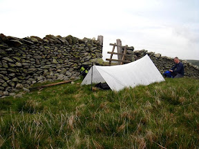
Anyhoot, enough of that morbid truth, so what has been going on? Well, I did have a bash at tarping back in June and as it as it was my first time (blush) who could better teach me the tricks of the trade than the craziest tarp aficionado around these parts: Mr Eddy Meechan! Wacky shaped cuban fibre aside, this one trip changed my whole outlook on lightweight backpacking - afterall you don't knock over 3kg off you total weight without a slight epiphany! Report due imminently.
In other news I have had to bite the bullet and fork out on some new walking poles. Those with a keen memory will know that I won't leave home without my poles but will also note that to date my current poles (LEKI vario XS) were aquired from TKMAX for £6.99 but weigh in a mere (386g)! I'm a small man (without the syndrome mind) so I just about get away with the max height of 110cm that these children's poles have to offer. Yes, that's right these are children specific poles! In light of this it was only a matter of time before the extra forces a sheer brute.........twerp like me can bring down on these things before something gave way. Over time the locking mechanism has perished and now the red 'rocket' section simply slips on the threaded screw under any kind of pressure and can't be serviced. Bummer! I knew this day would come so I'd been looking at the merits of various poles for while and I've settled on the Adjustable Goat Poles from Titanium Goat. More on those when they arrive but needless to say, these poles aren't just aid my pathetic knees and facilitate my move to tarping over the next 6 months or so. Those who want the all important lowdown can get their fix in my review shortly but in case you've not come across these yet, you get two (virtually indestructible) adjustable carbon fibre poles , weighing in at 107g per pole. Will let you know the actual weights once I've paid the Royal Mail ransom to get at them.
I have a trip planned for sometime in October but at the moment its looking like a solo trip unless Paul can work some magic. Not entirely sure yet but a recent trip to Snowdonia has got me thinking quite a lot.............

On today's show we've got some early low cloud and everybody's favourite - mountain dew...
I’ve not bought anything new for a while (at least not for backpacking!) and before I knew what was happening I was looking quite extensively for a better lighting solution for the hill.
My current lighting options are my Alpkit Gamma and the Black Diamond Ion which have done the job fairly well to date but with room for improvement. The Gamma is nothing short of a pocket disco but I now find it a bit cumbersome with the separate battery compartment and its not the lightest around at 118g with batteries. The Ion is better in terms of simplicity and weight at 30g all in, but the brightness drops off quickly and the batteries are a pain to get hold of locally and never seem to last very long.
The solution I wanted then needed to be light, bright, efficient and easy to use – oh, and not a Petzl of any kind! The criteria got a bit more specific from here too as I wanted a light that was great in the confined space of the tent, good for pottering around the camp and suitable for a bit of night walking should the need arise or the mood take me.
After a bit of internet searching it was not looking good and I even started to consider scrapping some of the criteria and getting an e-lite! The offerings weren’t bad but they were either too heavy, had an unsuitable beam pattern, bad battery life or had Petzl plastered all over them. Fortunately I stumbled across a forum which led me on a merry dance looking at mini led torches and whilst this wasn’t immediately fruitful it led me to the seedy underworld of task lighting….
The initial problem was that whilst generally very bright with efficient LEDs these task lights generally work in a wide flood mode to illuminate a wide area and weren’t always configured to wear as a head torch - so wouldn’t be overly suitable for use on the move or for night walking. More searching revealed some tests with various torches showing their flood beam and throw distance and here’s where I found Zebralight H30.
The majority of their torches have 3 simple modes, are incredibly bright and efficient and are fairly light but suffered from a wide flood beam of around 110-120°. The H30 however comes with an 80° beam and so I was interested enough to contact a UK seller with queries……

In brief the specs are as follows:
It comes with a few accessories like a headband, a silicon sleeve with clip and a glow in the dark holder so you can find it easily.

I know that it doesn’t immediately appear to be the most obvious choice but its quirky and meets all of the criteria. It takes CR123 camera batteries which are easy to get hold of and keep the weight and size of the torch to a minimum.
Construction is high quality anodised aluminium and comes with o-rings galore to make it waterproof – which is handy. I’ve already replaced the standard black rubber pushbutton with the supplied glow in the dark one and it works just enough so you can find in pitch darkness.
The lighting modes are easily accessible with 1 button press for on and holding it down toggles between all three lighting modes. Low is great for reading or just messing about in the tent not least because of the wider flood pattern compared to standard head torches. As there is no reflector I wasn’t expecting medium or high modes to be anywhere near as bright as they are and am pleasantly surprised with just how much light it throws out. The highest mode (at 80 lumens) gives off a wide flood that reaches just far enough for those night walks in to camp – probably reaching out to 15m or so.
What I find most useful is the lack of hotspot given off from the Cree LED which delivers a very useable and friendly light in all modes. Battery life remains to be tested but the quoted figures are respectable in my opinion.

I got mine from a UK supplier called Flashaholics, who were nothing but helpful and even tested the throw distance to make sure it would be suitable. The torch arrived the next day and on tearing open the envelope I was greeted with a free Photon Microlight, which really was a nice touch. Not everyday I get service like that and so I thoroughly recommend them.
It won’t be to everybody’s tastes as 80° is still quite a wide flood but its very usable with the both the headband and lapel clip and its surprising how much better it is having a bit more peripheral light to a standard reflector torch. It not the lightest yet I think it justifies its weight in the pack and adds value to my kit to boot.
DAY 3 Sunday 7 March 2010
Once again, I woke at various points throughout the night feeling cold. There was a light but persistent breeze and with the fly so high off the ground it was finding its way in and swirling around inside the tent. Perhaps this is one of the downfalls of the Scarp and hopefully Henry will soon have a replacement fly for the Scarp 2 as he has already with the Scarp 1. Not to let it get the better of me I just donned the down vest, had a Double Decker and went back to sleep!
I woke again just before 7 and decided I’d make a brew before getting out of the sleeping bag. There were considerable amounts of ice both inside and out on the flysheet but the instant gratification experienced when looking at the view from my bed distracted from the cold.
 Sunrise on Mellbreak from the tent
Once again pre-heating the fuel made lighting the stove easier and 10 minutes later we were dozing with hot cups of tea and some breakfast bars. Looking east the sun was just about to make an appearance over Great Round How and we eagerly awaited the soothing warmth that would soon engulf the cold, damp tent.
 The sun just touching the tent as we sat above the tarn soaking up the rays.
Though we wanted to de-pitch early (we were close to the path) it was hard not to want to just take it all in. We wondered around the tarn and sat on the tall rocky outcrop trying to capture some of the suns warming rays as early as possible!  Sunrise creeps up on Blackbeck Tarn
The sky was clear and the tops were bathed in the early morning glow – It was going to be another stunning day.
 Paul and his catalogue pose – he is available for photoshoots all over the UK and abroad, just tel: 07……..
Finally realising that we’d left it long enough, we headed back down pack away the tent. By the now the sun had made it to the frozen surface of the tarn and deep cracking sounds began to echo around the natural basin of rock.
 In no time at all the tent was down, our bags were packed and we were saying goodbye to another great pitch. Picking up the path Paul spoke of his ‘need’ for an inversion but Buttermere wasn’t playing host today. At the slate bothy we decided we would pick up the dismantled tramway directly over to the Honister Slate Mine as opposed to venturing up onto Fleetwith Pike as was the original plan. The track was buried in snow and as it rises to the crest, looking back we could see an inversion just licking over the edge of Looking Steed – Paul was well and truly gutted!
 An inversion teases Paul as we move west to the Honister Slate Mine.
The views all around were incredible and it was a shame to be leaving on such a perfect day. The old tramway is a very direct route across the fell and this was all happening a bit too quickly. The track is well trodden and the snow compacted and icy with the sun bouncing off it to burn my retinas. Up ahead, Paul’s pace slowed until he just stopped and looked bag with maniacal grin on his face. At first I just put this down to wind but as I approached it was clear what was going on.
 Paul slows up ahead, seemingly frozen as I approached along the dismantled tramway……
The view opened out and whilst Borrowdale wasn’t full with a swirling, milky inversion, the likes of Thirlmere and Grasmere were and we just stood there taking it all in as the sun beamed down on our wind-burnt skin. The Gods were playing with Paul but he didn’t care – it was close enough for him and I got a real sense he was going home all the happier for it.
 The stunning winter landscape ahead at the peak of the tramway.
We could see for miles, with Helvellyn prominent on the horizon, and seemed to show the inversion just who was boss.
 Hellvellyn above the inversion as it dominates Thirlmere.
The trip was drawing to a close as we dropped steeply down to the slate mine just as groups of people began to approach from the opposite direction. We’d timed it perfectly to claim the morning in the mountains to ourselves and there was nothing left to do but, save for Paul to tame an obligatory stone lion of course…..
 Paul shows his true modelling prowess – now available to work with animals!
Day 2 – Saturday 6 March 2010
I woke at 5 am feeling really cold in my bag but checking the Silva ADC showed I was being a big girl with the temperature a tropical 2.2˚ C! I reached over and pulled on my PHD down vest and bedded back in to my bag, all the time wondering why I felt so cold. The more I thought about it, the more I could feel cold spots and I noticed the bag wasn’t lofting quite as well as it normally does. Oddly the cold wasn’t coming from the ground despite using a Neoair on a bespoke foam mat. Trying to get back to sleep I mulled it over and remembered that unusually my bag was left semi compressed in the mesh storage sack and then stuffed away two nights before we left. Still confused I did what I always do and had a bar of chocolate before falling back to sleep until 7.30 when I awoke toasty warm! In hindsight I think a combo of a lack of calories and a damp, over-compressed sleeping bag might have been the problem which in turn = user error!
Waking up in the Scarp was a nice surprise as I’d forgotten how much easier it was to manoeuvre inside the tent with all the extra space. Paul was still snoozing so I popped the stove on which refused light because I’d forgotten to put it inside my sleeping bag to keep it warm. Holding the stove for a couple of seconds over a lighter did the trick and soon tea was on the boil and the day was officially starting.
On this trip, for simplicity, I’d swapped my porridge for breakfast bars and whilst its all very convenient I have to say it isn’t an experience I’ll repeat often – I’m all about a nice warm breakfast on the hill in the morning…..so shoot me!
Popping my head out of the porch I could see a muted orange glow beyond Robinson and hoped the weather would be as friendly as the forecast had suggested. With a slight breeze there was a chill in the air and exposed fingers soon got cold. We decided we’d hung around long enough so checked the map, packed away, pulled on our trusty packs and set off.
 Sunrise on Red Pike, High Crag and High Stile from Robinson.
The boggy terrain was still rock solid so we bumbled along the plateau of Buttermere Moss with gay abandon until I noticed a familiar feeling in my knee. In my younger years I would have just carried on with inconsiderate naivety until such time as my knee was too much agony to bear. Now however I’m much less interesting and feisty, so stifling calls for my “mummy” I decided to stop and put a knee support on. Of course its mostly placebo but it works for a time and I don’t knock it if it keeps me happy in the hills!
Soon we picked up the path heading down Robinson and into Buttermere, with Paul leading at a blazing pace that I struggled to maintain because of my knee. There were still a lot of icy patches on the rocky sections of path and foot placement became much more considered at times. It was a gruelling descent for me but soon the path rounded and Buttermere village came into view. The morning was brightening and we could see our familiar ascent up to Red Pike ahead.
We took a photo at the church steps to compare against our original one two years ago and reflected on our experience since then. Passing the two pubs (It was a few minutes early for a pint) we passed two walkers who were keen not to talk to us – fair enough as I wouldn’t talk to me either! Stood at the eastern shore, Buttermere was like a sheet of glass. There was no wind to speak of and save for the hazy overcast sky it would have made a nice picture.
 Grasmoor and Crummock water as we clear the trees on the first stage up to Bleaberry Tarn.
Once again Paul was on some sort of mission and almost ran up the boulder steps and up through the forest. By the time I got to him he was sat beyond the gate enjoying the more elevated views. I decided I needed to step my game up as I wasn’t used to trailing Paul and I didn’t like it one bit! The steep, winding path up to Bleaberry Tarn got the heart pumping and our pace was really picking up. As the path runs closest to the waterfall there was a long solid block of cloudy ice and with no other way past we gingerly slid our way forwards. Getting closer to the tarn there were more rink-like areas but here its easier to skirt around – but naturally much less fun!
 Paul testing the Gods on Bleaberry Tarn.
The tarn was completely frozen and Paul (with his ‘stick it to the man’ attitude) practically jumped on the ice and started skidding about! I’m no health and safety jobsworth or owt but he hadn’t even removed his pack and I wasn’t wholly happy until he stopped arsing around and rejoined solid ground. I don’t know whether it was the fear of him falling in or the fact that he had half of the tent and I didn’t fancy having to fetch it. Having said all of that I did film the occasion just in case the ice did give way, needing only a stamped address envelope for my chance to £250!
A choccy bar later and we were on the climb from the tarn to the summit of Red Pike. Sections of the path were frozen and as we got closer we could see the steep snow-clad scree run awaiting our arrival. The poles are pretty good in sections like this and I regained the lead position up to the summit cairn. By then the sun was well and truly out, though a stiff wind reminding us it was still March.
 The steep final ascent of Red Pike.
Resting at the cairn I phoned home, since it was the first reliable signal I’d had for 24 hours, whilst Paul called his mate about a trip to Vegas! Hmmm, I wonder which one of us is currently single!
 Beauty and the beast.
Picking up the track it was a clear Microspikes moment so rather than carry the weight in the pack we quickly chucked them on and continued on our way. There were deep sections all over the place where snow had drifted and it was glorious in the sunshine with the huge clouds adding even more drama to the occasion.
 Perfect view of the imposing and spectacular Pillar from Red Pike.
Two guys had ascended from Ennerdale and asked where we had come from and seemed to prophesize of treacherous conditions ahead – Gamlin End below High Crag in particular. I couldn’t see it myself – Gamlin End is a south east facing steep section which, even in snow and ice, could be tackled by the scree run to the left of the path. The younger chap of the two seemed adamant as we walked along at similar pace, with ice axe, sturdy winter boots and a wrist mounted GPS guiding him across the ridge. It was pointless arguing, he’d already eyed up our whacky lightweight packs and Microspikes and (albeit by facial expression) poo poo’d our claims of camping out the night before. Paul and I had both had enough and dropped back to let them get ahead. The view from the ridge was incredible from both sides and out of the breeze it was positively warm in the sun.
 Paul demonstrating how to avoid a cornice!
There were cornices a plenty to add to the mix of deep snow, ice, views and sun and I was in a good place. We checked our progress and our timing was ahead of schedule yet again. We’d moved far quicker up onto the ridge than planned and now despite trying to hold back we somehow had marched along the ridge to High Crag in no time. Pillar was looking particularly dominant across the valley with Great Gable and Kirk Fell chipping in.
 Taking in the scene of Kirk Fell, Great Gable and Green Gable.
Soon we’d caught up with the guys from earlier and as they took the path down Gamlin End, Paul and I opted for the fun option: scree running! As suspected the conditions were perfect, no ice and just a few small sections of persistent snow. Paul shot down first with me following 30 seconds behind. The childish whooping that seemed to come from the vicinity of my gob shall not be discussed further! It’s just great fun, especially when your sat down, shoes and socks off soaking up the rays by the time Captain Sensible and his friend had caught us up. I tried my hardest to stifle my smug grin as they passed but there were no hard feelings.
The sun was hot as we sat drinking tea and eating our lunch. Lemon and coriander couscous with spicy chorizo and chilli flakes is a mountain favourite of mine now. Its home-made (but can be bought in a variety of flavours), cheap and filling – if not a little lacking in the calorie department.
Whilst my knee was clearly not in a good way I was enjoying myself too much to care. I adjusted the support, necked some ibuprofen and donned the pack again. I felt rejuvenated and was looking forward to clambering up Hay Stacks but for some reason Paul doesn’t like Hay Stacks that much and says its because it damn near killed his spirit for backpacking the first time we did it! Today he wasn’t hindered by his heavy pack and as a result bolted on up. We passed a couple taking their time on a more difficult section who openly pondered the benefit of my poles and we chatted for a few minutes about who had the most pathetic knees. I think I might have won that one.
With time to kill we explored Hay Stacks a bit more than last time, finding quite a few other people doing the same. Compared to the rest of the trip it was a mountain motorway up there: There was a photographer and his mum at Innominate Tarn, a group of lads in shorts, two men with a dog and the couple from earlier who’d found their way up. We eventually sauntered down to the frozen tarn where once again, Paul selfishly risked the tent like the childish buffoon he his, to which I could only respond by getting the camera out again to increase my chances to win £250. He wasn’t quite as confident as before though and the cracks and bubbling water soon had him retreating to the edge.
 “That’s it, right a bit……bit more”.
Hay Stacks is pretty rocky and boggy but I wanted to look around for a place to camp that wasn’t as obvious as by the tarn. Dry, flat spots are pretty rare and I didn’t find anywhere I’d want to pitch a tent – better luck next time maybe? Timing-wise we could relax. We were way too early to pitch anywhere and as we didn’t plan on pitching on Fleetwith Pike, we had more time to kill. We highlighted Blackbeck Tarn with a view to pitching somewhere around there or Green Crags overlooking Buttermere for a romantic pitch for two!
 Buttermere and Crummock from the path crossing the beginning of Black Beck.
As before our bumbling around wasted little time and we were soon at the Tarn filling up our reservoirs and scouting for a pitch. The tarn was frozen here too and no prizes for guessing what happened next! We dropped the bags out of sight of the path which crosses directly over Black Beck. Wondering around Green Crags we looked for a suitable pitch and soon Paul called out with a possible place. Looking at it from every angle we decided whilst it wasn’t flat, was covered in sheep doo and would be a real squeeze, that we’d try it anyway. Retrieving the bags, we passed the photographer from before and a group of guys and girls who tried their hardest to break the ice with whatever rocks they could find. Paul said nothing but I think he was crying inside.
 3rd tarn lucky – This time its Blackbeck.
Back at the pitch it wasn’t looking good and try as we did the big fat Scarp 2 was not going to fit. Even if it had, it was one of those pitches where you only had one chance of getting out of the tent without seeing your life flash before you! A bit disappointed we continued our search but any flat spots big enough for the scarp were either boggy or just boring. With that we retreated back to the tarn where it was now fairly safe to pitch without being seen.
 Sit mat, White Russian, twerp spoiling the view – DONE.
With the tent up and a faint sunset arriving we grabbed our second flask of White Russian and headed for Green Crags with our sit mats. It was a great spot and we reminisced again about our first night wild camping near here two years ago. This time around we were far less tired, more comfortable and in a fit state to enjoy the view to fullest extent. It’s at times like this when the benefits of going lightweight become apparent: We’d moved faster, easier and with more comfort than our previous time here and this time we’d already done one night in the hills.
 Just inserting this picture gives me pangs!
Whilst we sat taking in the views and talking crap two chaps wondered close by, who seemed to be looking for a pitch. They didn’t see us but we assumed they must have passed by the tent and decided to try further on. We saw no more of them and for that I was happy as I can’t imagine what it would be like to share a spot like that with strangers.
 Our final view from Green Crags as the sun sets on our final night of the trip.
DAY 1 – Friday 5 March 2010
Nostalgic sentiment (some might say destiny), took us back to Buttermere to re-sit our backpacking proficiency exams in March. We’d taken this test once before just over two years ago, when (like most exams….or at least mine) we rocked up after a night of heavy reading and last minute panics to try our hands at camping in the hills for the first time. Our test results were documented in my first ever trip report here:
 Our start point at the Honister Pass
It was hard not to go back and do it all again, not least because our packs were so heavy the first time around that we had to cut our second day short. I’d mentioned it a while ago, Paul was keen and all of a sudden we were parked just before the slate mine on Honister Pass, donning packs at least 7kg lighter than two years ago! Back then we had too much gusto and not enough sense: Paul was wearing his dad’s trousers and waterproofs, we had 1kg foldaway stools and the only piece of ‘lightweight’ equipment between us was my Isofly stove from MDB.
Today, the weather was windy with huge clouds rolling around and not too cold, despite the snow on the tops. This time were doing the route a different way and starting at the Honister slate mine and going anti-clockwise over the tops around Buttermere Lake and back to the mine over two days (Route taken from Geoff off of V-G).
The ascent up Dale Head was an energetic start to the route and was littered with false summits to keep us guessing. We passed a large group of young backpackers making the same ascent, who seems to stop low down with just about everybody waving a map around and going nowhere fast. We continued on the ascent meeting our first patches of snow which, as always, we had to jump about it in like a pair of morons! That feeling of freedom and fortune began to set in, egged on by the fact I wasn’t sat in a world of liability clauses and contract schedules.
 Base Brown, Glamara and Great Gable strike a pose.
The views south-east were stunning with the likes of Glamara and Great Gable covered in snow and the cloud base just teetering above the tops. Every now and then the sun would make an appearance giving a burst of bright light across the terrain that was nothing short of blinding at times. Note to self: pack sunglasses!
I was back in the layering game with my clothing for this trip and yet again it proved itself as versatile and flexible. My Montane wind shirt proving its measly weight isn’t its only party piece.
 Paul modelling his 1 hour old Microspikes on the hard stuff.
We were soon well and truly in the deep stuff and although hardened by a good freeze/thaw cycle there were deep sections bridging hidden rocks which seems to pull you in unexpectedly. What with this and the hard crust on the incline we donned Microspikes (because we could) which excelled in the conditions. Soon we were at the trig point on Dale Head and the reward was clearly the views. It was both dramatic and imposing and I just wish I could get out more in winter. We stood around getting buffeted by the wind just trying to take it all in. We posed for the obligatory “look at this pair of twerps on the summit” photo and explored the plateau whilst there was no one on it!
 The view down the valley to Little Town and Newlands from the summit of Dale Head.
The valley below Dale Head Crags running north to Newlands would make a nice low wild camp spot, so I made a mental note and we pressed on. We weren’t in any hurry today as we had an easy walk west along Littledale edge, onto Robinson and finishing up at Buttermere moss to camp. It was great to know we could take it all in, though we were quietly excited about using the new Scarp 2 for the first time!
 A wintry Hinscarth Edge.
We happened upon a retired couple from Cockermouth who were attempting to climb all of the Wainwrights before the chap’s 65th birthday. They were doing incredibly well having climbed 103 since May last year. They owned the campervan parked next to us and had just popped over to ‘do’ Robinson which they’d missed previously due to bad weather. They let us know the conditions ahead were much the same as we’d had along the ridge and took great interest in the Microspikes we were both donning. They seemed impressed when we gave a brief demonstration and seemed quite concerned that we’d be camping in these conditions! Assurances were given, we said our farewells and we continued on our merry way.
 On our merry way….
Checking the time it dawned on us we’d still been moving far too quickly and we had some considerable time to kill before making camp. At the next climb before Robinson we sat down for a late lunch and a brew to just take in the views. As soon as we stopped the cold set in and down jackets came out with urgency! To counter the extra weight of the Scarp 2 over the Seedhouse SL2 we’d chosen to rely on just one stove and the Caldera Keg had made the cut. It happily boiled our water in no time and we watched people move from the eastern descent of Robison to Hindscarth. Their small dark shapes against the snow giving the hills some much needed scale and perspective.
Packing away and continuing on it was clear we would hit Robinson earlier than planned but we’d hardly seen anyone all day and we were happy to camp early if we found the right place. Blue sky was starting to break through more frequently now giving some great views across the fells.
 Awesome views from the summit shelter on Robinson.
Somewhere from the summit of Robinson we lost the path in the snow so we made a slippery descent down to Buttermere Moss, once again letting the Microspikes take the strain. The snow here was deeper and fairly soft but was short lived as we dropped down to pick up the path. We stopped at a good spot above the plateau below to search for a running water source and gauge the lay of the land for a camp spot. Anything outside of freezing leaves Buttermere Moss a squelchy and arduous crossing! We pondered and procrastinated until we gave up being stubborn and pulled out the map. We located a flat section above Goat Crag with a view to gathering water from Goat Gills and marched with that plan in mind.
Fortunately the wind dropped the further we did and we were happier with the conditions as feet hit frozen bog confirming that we’d have no issues losing shoes in it today!
The spot we picked on the map was pretty much perfect and mindful of time we dumped bags on the sport (as if in some way to claim it as ours!) and made the unrewarding drop down to further spur of Goat Gills to fetch our water for the night and following morning. By the time we dropped down to reach it my left knee wasn’t happy and I was immediately concerned about the route ahead for the following day. Sometimes I loath my useless body.
By the time we filled both Platys and fought our way back up to our chosen spot we used all of an extra 10 mins so we bit the bullet and unpacked the tent. We were happy that although it was only 4.35 it would be dark in an hour and our position was hidden from all but the opposite fells.
What followed next can only be described as a kind of tent to ground mating dance as we measured up the best spot and to avoid the slight slope to one side. This was the first time we’d used the Scarp 2 since Paul received it it went up like a dream. So quick and easy to get a perfectly taught and stable pitch. Despite only having a slight wind we decided to use the cross-poles, primarily as we’d carried bloody things all that way so we were damn well going to use them! Having a porch each was luxury enough but climbing inside I couldn’t believe how much extra room we had, despite Pauls earlier claims. It was going to be a good night.
 Fiery clouds licking the top of High Stile and High Crag from the pitch.
Winter nights are long so despite being ravenous we decided to delay the evening meal and wolf down some chocolate instead. Paul pulled out his show piece of a dark chocolate Toblerone whilst I with a 75% cacao Green & Blacks. You need a little luxury in the hills when it comes to chocolate! Despite our childish excitement at these coveted treats, the best was still to come in the form of a hipflask full of White Russian with our own little twist just to pack more punch (If I tell you I’ll have to kill you….).
It was great to be able to explore for a bit and take in the views from above Buttermere. It seems like no time at all before the sun was setting and we were treated to some particularly pink reflection through the cloud. The rest of the night was spent cooking, eating, sipping White Russians and chatting til late and then my IPod went on until I dozed off.
It had been an easy day for a change but any night spent in the hills is infinitely rewarding and besides, we had a nice long one waiting for us just a few hours away…..
 Sunset from the pitch on Buttermere Moss – A possible Scarp 2 promo shot?


